
Walk a Prairie Village Street
A Prairie Village street directory search works best as a chain. The Johnson County tax card identifies a parcel and its recorded owner. AIMS then places that parcel among the lots around it. The Register of Deeds connects the current owner to earlier transfers, while election records and address-keyed library volumes may identify people associated with the address. Keep ownership and occupancy separate. A deed names parties to a land transfer; it does not list every person who slept in the house.
- Enter the house number and street name in the Johnson County property-tax search. Save the Quick Reference ID, situs address, legal description, and owner name.
- Open the same address in the AIMS public map. Check parcel lines, subdivision, plat, city, ZIP, and adjacent lots.
- Use Kansas VoterView only when the required name and birth date are known. A match confirms registration details, not a complete household.
- Follow the owner through the Johnson County Register of Deeds. Match the legal description before accepting a same-name result.
- For an earlier household, consult the Johnson County Library's address-keyed Cole volumes. Full collection detail belongs on the Prairie Village city directory page.
This order limits false matches. It also preserves the exact parcel key when the postal city, subdivision name, or street form changes between systems.
Normalize Prairie Village Addresses
County help text calls the physical location the situs address. Search it with the street number and name, and omit the street type or direction when the results screen asks for that form. A mailing address is different: it is where the tax notice goes and may be outside Prairie Village. USPS last-line labels also vary. A parcel inside the city can use a postal label associated with Leawood or Overland Park in ZIPs 66206, 66207, and 66208.
If an address fails, try the bare street name, then the parcel ID, subdivision, lot and block, or legal description. AIMS can search an intersection and can limit results to the current map extent. No official citywide renumbering schedule was found, so an older address should be checked against a directory from the same era and the recorded plat rather than silently converted to a modern number.
Search Prairie Village Streets in AIMS
AIMS is the strongest map view for a Prairie Village street directory. Its layers include parcels, address points, building footprints, zoning, flood zones, schools, cities, plats, subdivisions, neighborhoods, and transportation. The viewer can draw a shape, select parcels within a measured buffer, and open results in a new window. Owner searches accept last-name-first order; an underscore stands for one character and a percent sign for any length of text.
| Search mode | Useful entry | Result value |
|---|---|---|
| Address | House number and street | Parcel and situs match |
| Property ID | Saved parcel key | Exact tax-map record |
| Owner | Last name, first name, or business | Parcels tied to that owner |
| ZIP or city | 66206, 66207, 66208, or Prairie Village | Geographic filtering, not proof of city limits |
| Legal | Subdivision, plat, lot, block | Recorded land identity |
AIMS compiles data from deeds, plats, tax records, and other public sources. Confirm a decisive point in the primary deed or tax record.
Prairie Village Street Record Layers
Each address-keyed source answers a narrow question. Search by street across several layers, but carry the parcel ID and legal description between them. Those stable keys prevent a mailing address or repeated surname from being mistaken for the physical property.
| Record Set | Keeper | What It Shows | Access |
|---|---|---|---|
| Property and tax card | Johnson County tax office | Owner, mailing and situs addresses, legal description, values, tax history | Free web search |
| AIMS parcel map | Johnson County AIMS | Lots, plats, zoning, districts, schools, city and ZIP layers | Free viewer |
| Deeds and liens | Johnson County Register of Deeds | Recorded transfers, parties, dates, instruments, and legal descriptions | Public terminal; copies cost 25 cents per page |
| Voter record | Kansas and county election offices | Registration and polling details for a known person | VoterView or lawful data request |
| Permits and code cases | Prairie Village Community Development | Address-linked work and case records | OpenGov route or KORA request |
The city reported 1,983 code cases and 1,624 permits in 2023, followed by 1,789 cases and 1,696 permits in 2024. Those figures show how much new address evidence is created even when no resident list exists. The live permit search could not be confirmed during research, so use the Prairie Village OpenGov portal first and the city's records-request route when a file is not exposed.
Read Prairie Village Parcel Terms
Street records use land terms that do not mean the same thing. Learning the small distinctions makes a by-address search much more reliable.
- Parcel
- A mapped unit of land with its own county identifier.
- Situs address
- The physical location of the parcel, distinct from the owner's mailing address.
- Plat
- A recorded map that divides land into lots, blocks, streets, and easements.
- Criss-cross directory
- A directory arranged by address or phone number instead of surname.
A Prairie Village sample tax card lists a Quick Reference ID, situs and mailing address, legal description, taxing unit, neighborhood, map, owner ID, and tax history. Treat the card as an index to the property, not as proof that each named owner lives there.
Follow Prairie Village Deeds by Street
Start with the current grantee, the person receiving title, and search backward for the deed in which that person was the grantee. The prior grantor then becomes the next search name. At each link, compare the instrument date, recording number, and legal description. A trust, estate, lot split, consolidation, or replat can create a branch that a surname-only search will miss.
The county document library describes online documents for 1920 through 1987 and plats from 1866 forward. A separate subscription description covered a 1920-forward index and related images. These are different layers, not one uniform cutoff. The old subscription ended July 1, 2026, and the county expected a new electronic records management system in fall 2026. When web access stops, the free public terminal at 111 S. Cherry Street in Olathe is the firm fallback. Email and office requests can supply copies.
The county deed access screen shows the interface readers may encounter.
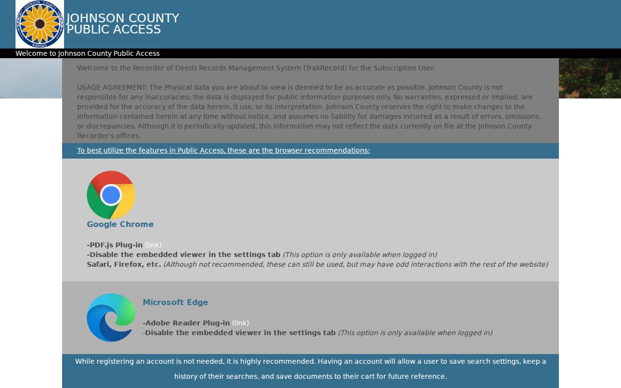
The screen is a doorway to recorded instruments, while the parcel's legal description remains the check against a wrong person or property.
When Prairie Village Web Records Stop
Online access is only one channel. The Register's terminal is free, ordinary copies cost 25 cents per page, and certification adds a separate fee. Johnson County Archives holds tax rolls from 1862 through 2007 and takes research-room visits by appointment. Staff provide up to 30 minutes of research before charging $25 per hour, so ask for a tract, year, or record series rather than a broad surname search.
The Johnson County Museum keeps Prairie Village property abstracts spanning 1855 through 1985. Those abstracts can bridge farm-era descriptions to later subdivisions. Kansas Historical Society series add county deeds from 1857 through 1995. A KORA request under the Kansas Open Records Act can seek an existing, nonexempt address record; the county says it will respond in writing within three business days or state that more time is needed.
Prairie Village Streets Cross Geographies
Prairie Village is landlocked and surrounded by other cities. Its municipal boundary, postal city, ZIP, precinct, subdivision, and tax situs do not always use the same label. That mismatch is normal. Preserve each label exactly as its source reports it, then use the parcel ID to connect the files.
Recorded plats give a useful time frame. AIMS samples show Prairie Hills recorded in 1950, Indian Fields in 1953, Corinth Meadows in 1955, Somerset Acres West in 1956, and Normandy Square in 1961. A street can therefore lead from an early farm description to a postwar lot and block. City history adds the broader sequence: home construction began in 1941, Prairie Village was recognized as a planned community in 1949, incorporated in 1951, and became a first-class city in 1957.
Note: A ZIP or postal-city match narrows the search, but only the municipal or parcel layer confirms that an address lies in Prairie Village.
Prairie Village Streets in Reverse
Johnson County Library catalogs Cole cross-reference directories for 1985 through 2000 and a later series listed from 2001 to the present. These in-library volumes arrange information by address, making them a strong street directory companion after the parcel is normalized. Polk county directory runs cover 1997 through 2000 and later north and south county listings.
Copy the printed address and household notation exactly. Then compare adjacent years, an obituary citation, and the deed date. A reverse entry can show a person associated with a home, but it can lag a move or omit a household. The source is most useful as a dated snapshot.
Limits of Prairie Village Street Records
No official source supplies a complete list of everyone living at a Prairie Village address. An owner may live elsewhere. A voter record covers registered voters, not all household members, and protected addresses can be concealed. Driver and vehicle address data is restricted, while utility customer lists are not a public household directory. Same names and delayed updates create further risk.
Label each conclusion by its evidence: recorded owner, tax-mail recipient, registered voter, directory entry, or possible occupant. Never merge those labels into a claim that the sources cannot support. K.S.A. 45-230 also restricts prohibited commercial solicitation from public lists of names and addresses.
Lawful use. Prairie Village address records support lawful personal research, property questions, and family history. Never use them to stalk, harass, threaten, or expose a protected person.